This article is part 2 in a series on the value that open data can bring to educational curriculum, specifically at The University of Pennsylvania School of Design. In Part 1, read how students use real-world data to tackle big issues.
Lesser known fact about Lexington, Kentucky: Anyone with an internet connection and only 1.6 MB of storage can download the city’s vacant- property data. Same thing with Chicago, New York City, and Philadelphia too, although the files are a little larger.
They’re all cities active in the “open data movement,” which, since 2011, has spurred governments and organizations to share information publicly. The movement has been a boon in urban planning education, as students make analyses that can be used across multiple cities.
“What becomes best practice in one place can very easily translate to another,” said professor Ken Steif. “And so it’s not just about open data – it’s about open analytics. Post some code on the internet and you can recreate someone’s anaylsis right there.”
To urban designers — a different, but related discipline to urban planning — real data can provide valuable context for decision making.
Before delving into a building design, graduate architecture student Keven Bloomfield generates 3D models of the surrounding area — an exercise he’s been doing since he learned it in his undergrad studies at the University of Kentucky.
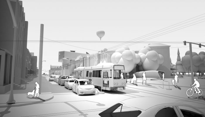
Using the Building Footprints shapefile hosted on OpenDataPhilly, United States Geological Survey file, and Google Earth imagery, Bloomfield generated all of Philadelphia’s buildings, topography, water bodies, and transportation divided by neighborhood. In East Parkside — the site of his design — he even generated door handles and window mullions.
The Building Footprints dataset was released by the GIS Services Group (GSG), part of the City’s Office of Innovation and Technology (OIT), earlier this year.
“I personally feel that sometimes the messy and the complicated and the dirty aren’t always all the bad. Why would you hide the fact that your fantastic skyscraper is right next to a rundown McDonalds? Put that in there.” Bloomfield said.
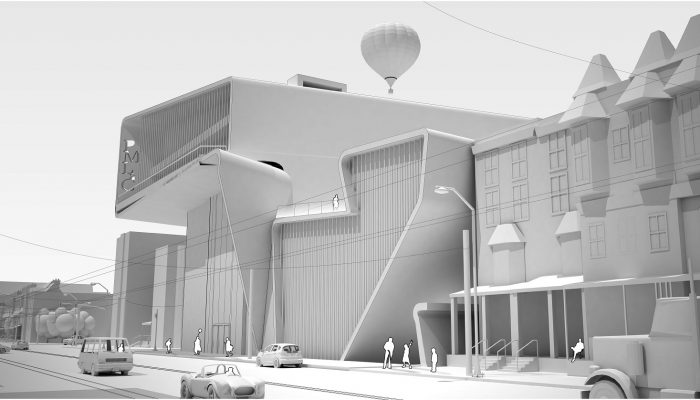
A 3D render of Keven Bloomfield’s design of a library in East Parkside in Philadelphia.
To Bloomfield, without the context of surrounding buildings and landscape, it’s easier for people to misread an architect’s intentions. An all-glass building may seem less appealing if a model shows it directly facing a dumpster. Similarly, a building’s blank walls could clash with the existing streetscape and take the energy away from Philadelphia’s neighborhoods.
Because of that, the City of Philadelphia’s Chief Geographic Information Officer, Mark Wheeler, encourages planners and designers to make more use of the City’s freely-available LiDAR data, a set of high-resolution, 3D imagery collected annually via aircraft. Wheeler’s team, GSG, has made this data available to City geospatial analysts and the public for 2008, 2010 and 2015.
“Anyone doing a construction project, architecting a building, could have access. We just provide that for free,” Wheeler said. “We just wish more people took advantage of it and came to public meetings with their 3D models.”
Developers could show potential changes to an area in detail, Wheeler explained — a perspective that can help communities and decision makers understand the impact of a potential project.
Wheeler also described the value of universities using open data to propose solutions to issues City Government doesn’t have the capacity to tackle. “They can research it and come up with ideas and solutions around a specific problem – having access to our data [makes their] solutions all the more applicable or easier to implement.”
In this way, open data can become a mutually beneficial tool. For students and teachers, it can ground educational theory and techniques in real-world needs. For the city as a whole, these more meaningful projects could accelerate problem-solving and enhance City government efforts to improve the quality of life in Philadelphia.