Imagine an application that can help families find housing by the proximity of good jobs, quality schools, public transit, and healthy corner stores. Imagine tools that allow local governments or funders to analyze community trends to make informed decisions about what interventions to prioritize. Imagine if neighborhood residents could use data visualizations to make the case for policy changes or the need for more resources in their community.
All of these tools are actually possible through open data. This last Monday saw the public launch of The Opportunity Project, in which the White House, Department of Housing and Urban Development (HUD), Census Bureau, and Presidential Innovation Fellows connected a diverse set of stakeholders to make these types of tools a reality. The effort can now be found on Opportunity.census.gov. The site allows families, community leaders, nonprofits, local officials, and the media to navigate information about neighborhood-level opportunities, such as access to jobs, transit, and good schools.
By bringing together software developers to create prototypes and local leaders to provide assessments, The Opportunity Project will leverage technology and data to create tailored, highly relevant, and user-friendly tools.
The City of Philadelphia’s Open Data team served as a local data partner, represented by Tim Wisniewski, Chief Data Officer, and Kistine Carolan, Data Services Manager. The team engaged three neighborhood leaders and staff from the People’s Emergency Center (PEC) to serve as experts in the challenges facing low-income communities and provide feedback on the digital tools developers have been creating for this project.
“This initiative asked developers, data scientists, and community members to connect and think about how we can work together to solve problems and ensure equal opportunity to information. As a single mother, I am thankful that the projects are being designed with people like myself in mind,” said Jeannine Cook, the Center for Digital Inclusion and Technology Youth Program Manager at PEC.
Additional PEC staff who helped provide feedback included Cassandra Green, Community Outreach and Partnership Manager and Tan Vu, Digital Inclusion Director. PEC is a local nonprofit focused on strengthening families and neighborhoods, with a rich history in engaging in digital inclusion work. Located in the West Philadelphia Promise Zone (see map), PEC operates in one of 5 urban areas nationally designated in 2014 by President Obama for investments to increase opportunity, improve quality education access, decrease crime, and create jobs. PEC’s Make Your Mark resident-driven community plan and the local We are Mantua neighborhood plan, facilitated by Mt. Vernon Manor CDC, played a pivotal role in attaining Promise Zone designation for this area, which has an overall poverty rate of 50.78% (twice that of the city as a whole).
For Philadelphia, developing anti-poverty solutions is personal. Areas of concentrated poverty often also feature high rates of unemployment, crime, health disparities, inadequate early care and education, struggling schools, and capital disinvestment. Philadelphia ranks third in poverty among the United States’ 10 biggest cities.
Other local stakeholders have contributed to this national initiative as well. Philadelphia-based Azavea and PolicyMap are participating software companies.
Azavea created the Transit Analyst tool, which provides interactive mapping for exploring relative transit accessibility to resources around the Philadelphia metro area, including health clinics, Head Start centers, recreation centers, healthy corner stores, parks, and playgrounds. They intend for planners or advocates to use this tool to identify opportunities to improve access to resources, either by adding resource locations, or modifying available transit services. An overview of their methodology for creating the Transit Analyst is available on GitHub.
PolicyMap released a tool to help individuals and families looking to buy or rent a home in Philadelphia find neighborhoods with the characteristics that reflect their priorities, using specific housing, education, transportation and demographic criteria.
“After being invited by the White House to build a tool in a few short weeks for the Opportunity Project, we realized we already had much of the data they had provided, and that we had a nimble platform in PolicyMap that we could leverage for the effort. The PolicyMap infrastructure and our expertise with the data and community development issues made it simple for us to quickly design a tool that would allow users to easily specify what opportunity means to them,” said Elizabeth Nash, Director of Data and Product Development, PolicyMap.
Keep in Touch!
For information about City datasets and others, go to OpenDataPhilly.org. Visit this resources page for video tutorials and links to tools to help analyze data. Follow @PhilaGovData on Twitter to get alerts on future data releases, share how you plan to use open data with data@phila.gov, and join us on the public open data google forum.
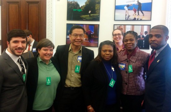
Photo Caption: A few of the Philadelphia partners working to improve access to opportunity through open data and strategic collaborations pictured at the Expanding Opportunity demo of digital tools in the Eisenhower Executive Office Building in Washington DC. Pictured from right to left: Michael Maurizi (Azavea); Kistine Carolan (City of Philadelphia, Open Data team); Tan Vu (PEC); Cassandra Green (PEC); Kathryn Killebrew (Azavea); Bettye Ferguson, (Belmont Alliance Civic Association CDC), De’Wayne A. Drummond (Mantua Civic Association).